Sandro Manteiga
Computer Engineer specialized in robust architectures, GIS systems, and scalable solution development with Java and React.
Projects fully developed for own clients

Laura Villar — Moda dende Galiza
lauravillar.galFull e-commerce for a Galician fashion brand. End-to-end development: starting from an external design by Marcos Puente, I built a custom CMS with Sanity, integrated a dual payment gateway (Stripe + Bizum), SEO optimization and production deployment. The result: a fast, professional online store aligned with the brand identity.
Want an online store as fast and professional as this one?
High-demand projects developed within multidisciplinary teams. Solutions focused on industrial process digitalization, critical GIS systems, and high-performance data visualization.
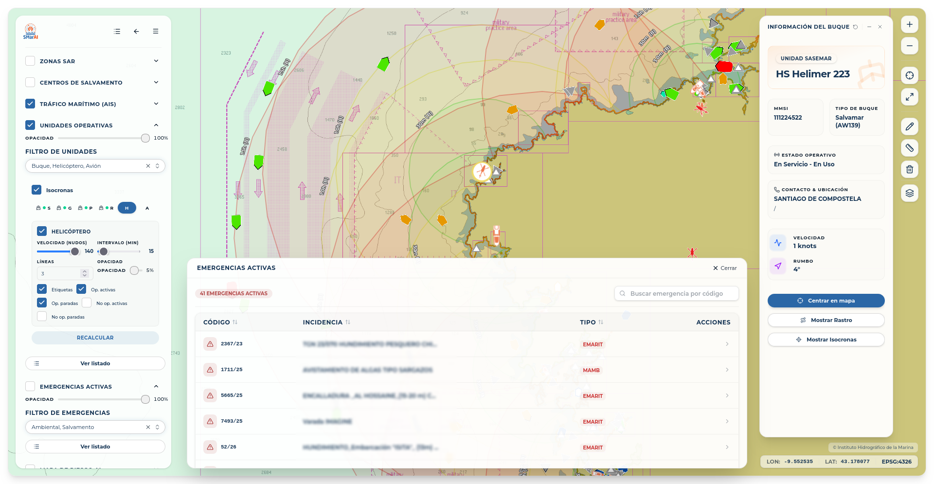
SMarAI
SASEMAR (Ministerio de Transportes y Movilidad Sostible)
Development of a GIS web operational viewer for AI-based decision making and maritime emergency management.
Development of an interactive SaaS platform integrating AI risk prediction models, maritime traffic (AIS), and operative unit positioning. The application allows visualization of risk heat maps, report generation, custom alarm management, and scenario simulation for optimal allocation of maritime and aerial resources.
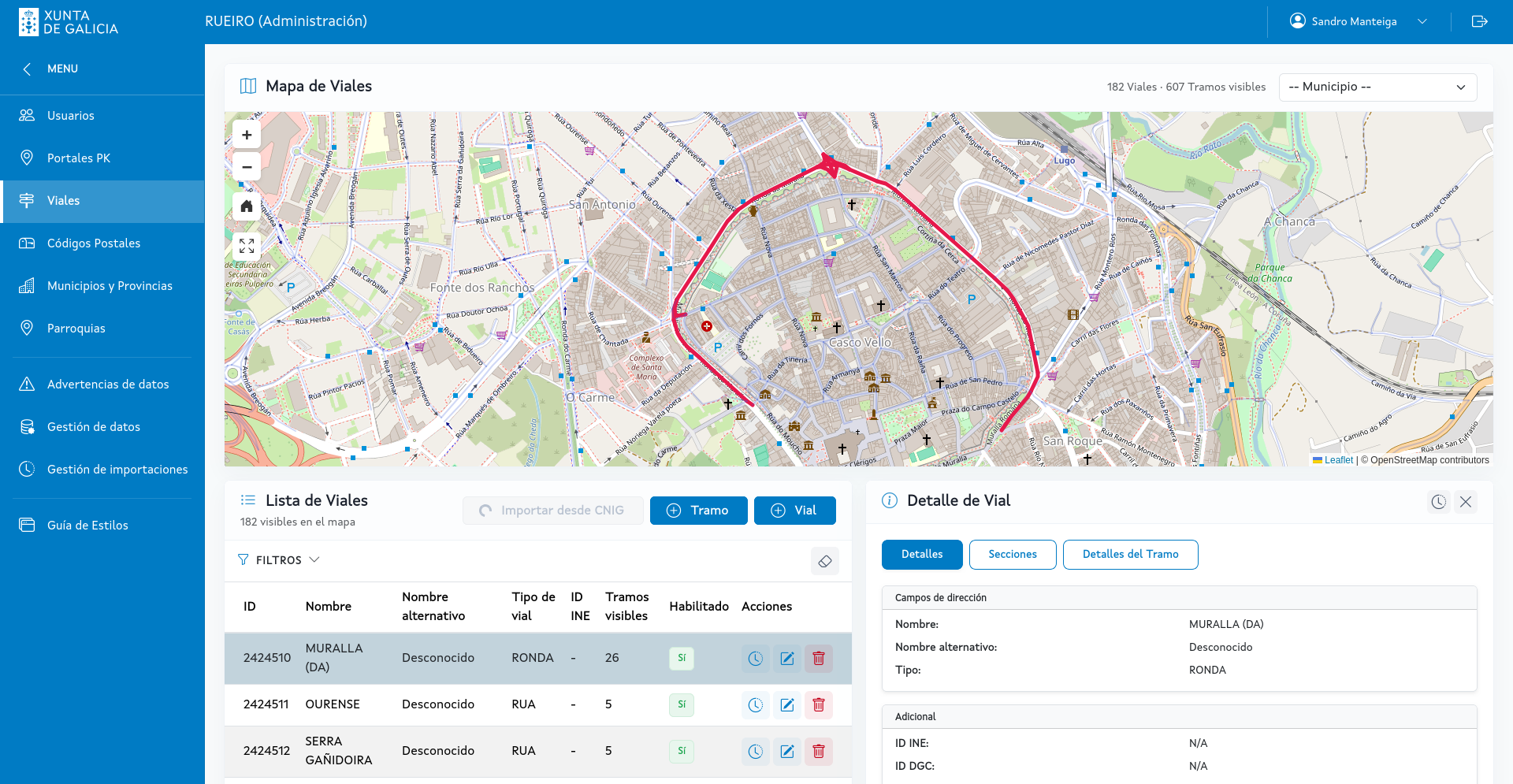
DIRTER - Geocoding System
AMTEGA (Xunta de Galicia)
Transversal territorial geocoding system. Development of the municipal management portal for digitizing and synchronizing addresses and roads at the regional level.
DIRTER is the critical infrastructure of the Xunta de Galicia designed to optimize emergency and logistics services through geocoding. My work focuses primarily on the DIRTER_Colabora subproject: developing the private web application (Angular) for local entities and municipalities to manage, edit, and synchronize their own street maps, addresses, and points of interest with the central database (Oracle 19c + SDE). I integrate cartographic viewers based on corporate ArcGIS tools, providing municipalities with a precise spatial editing environment that ensures the quality and governance of territorial data across the entire region.
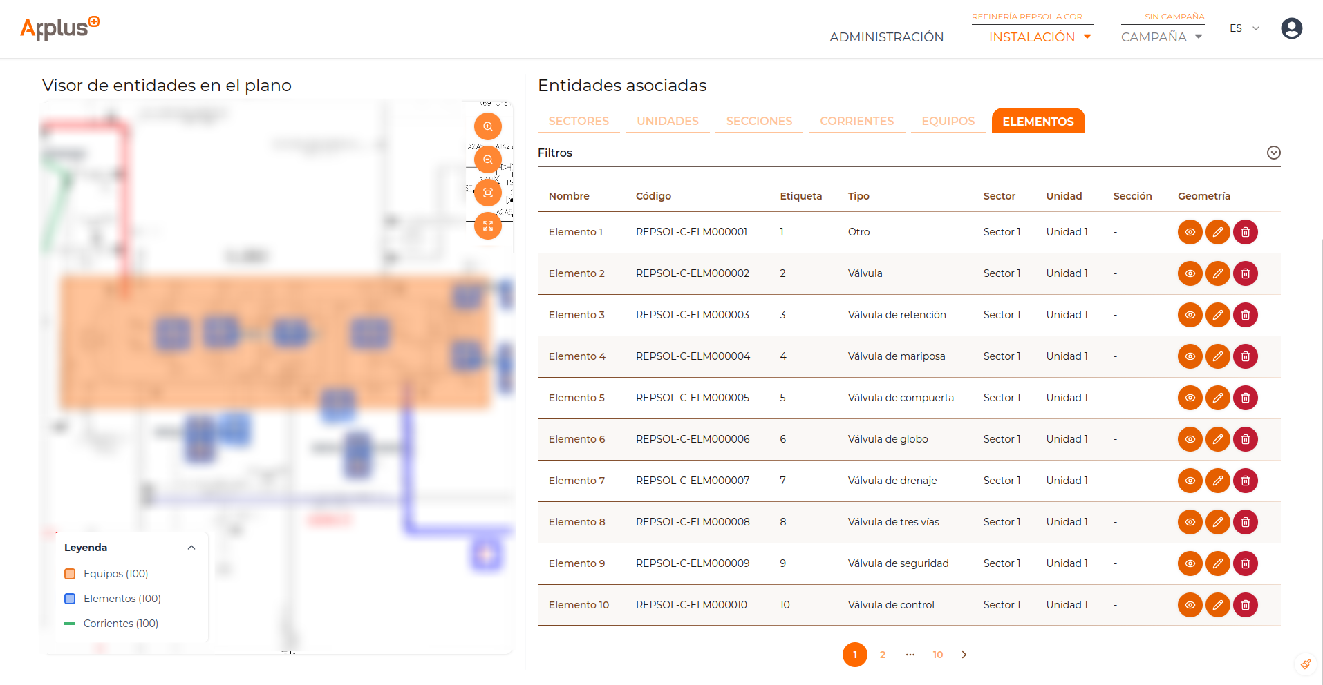
FEMA+
Applus Norcontrol SLU
Comprehensive web solution for managing Volatile Organic Compound (VOC) emissions. Includes data analytics and digitalization of the technical workflow.
As part of the Full-Stack development team, I participated in building this scalable platform based on microservices and Docker containers. My activity focused on developing analytical dashboards for leak monitoring and implementing the business logic for the field technicians' and office administrators' workflow. The project complies with ISO 27001 industrial cybersecurity standards, ensuring interoperability with complex corporate systems.
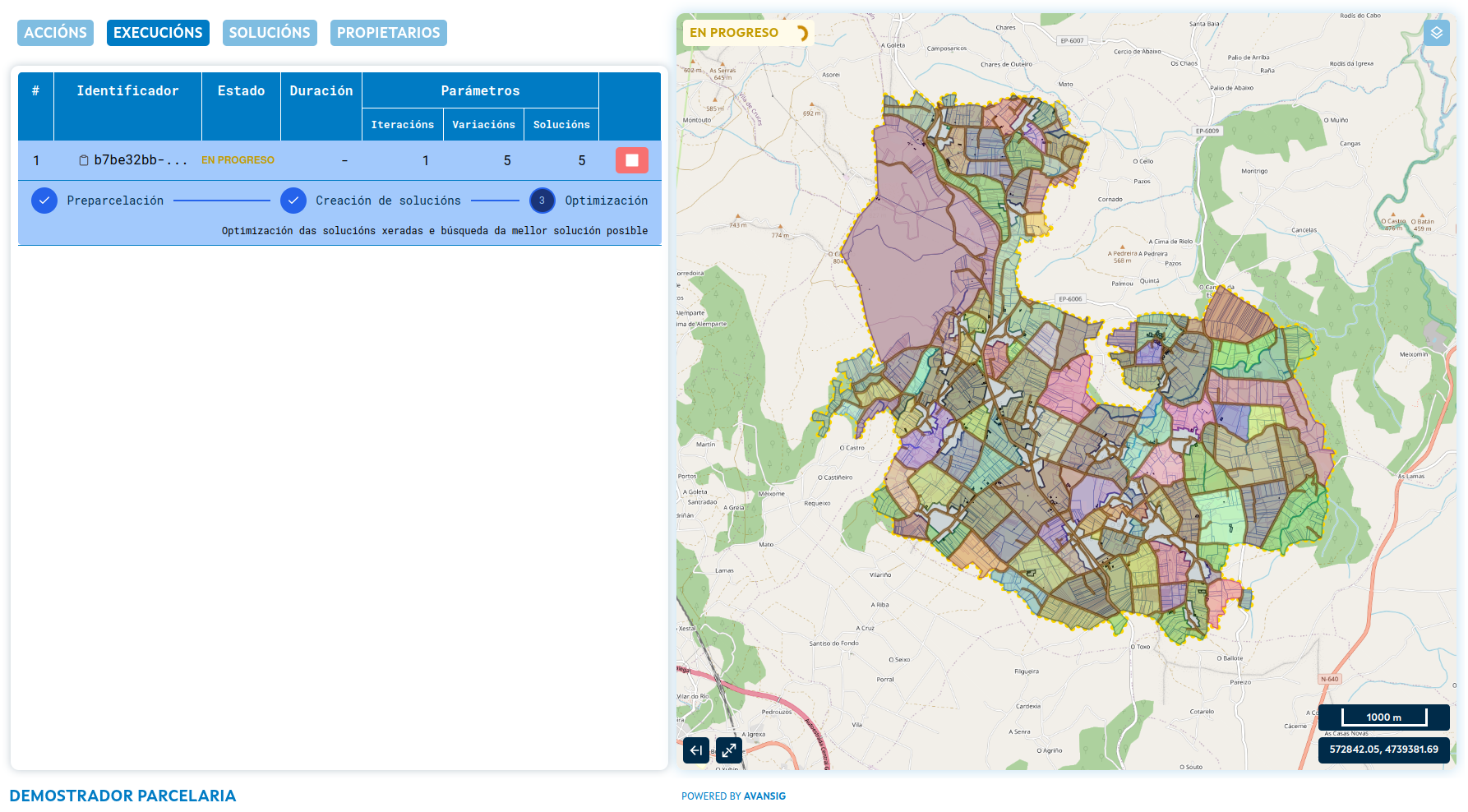
Land Consolidation Algorithm
Consellería do Medio Rural (Xunta de Galicia)
Territorial optimization system based on algorithms for land consolidation project design. Includes an advanced viewer for validation and monitoring of optimal solutions.
This project, part of the Galicia RDP and co-financed by the EAFRD fund, involved developing algorithmic techniques and procedures to improve agricultural and forestry structures. My involvement focused on frontend development and a demonstrator application with an advanced cartographic viewer, designed for real-time monitoring and validation of algorithm-generated results. I also collaborated on optimizing the spatial database and backend to ensure the technical viability of the solutions. The success of the system allowed me to represent the team at JIIDE 2025, where I presented the milestones achieved in the digitalization of these processes.
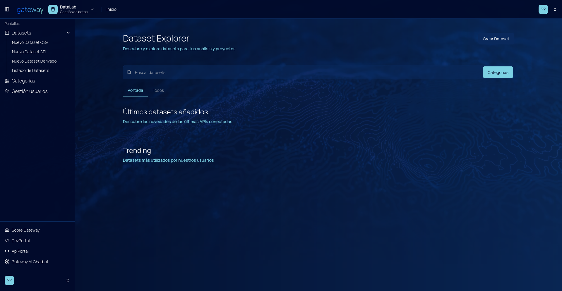
Gateway Control Panel
STGO & Navantia
Control panel for naval asset management using digital twins. Centralizes massive data flows from the Navantia Gateway API Portal for advanced visualization.
Within the DIFACNA project framework, I collaborated on developing this prototype for the integrated management and predictive modeling of naval shipyards. My work focused on implementing a web interface capable of consuming and unifying Navantia Gateway APIs, validating behavior and management models in an experimental pilot test. The system allows digital twin monitoring through high-performance dashboards, transforming complex industrial process data into key visual information for strategic decision-making at the shipyard.
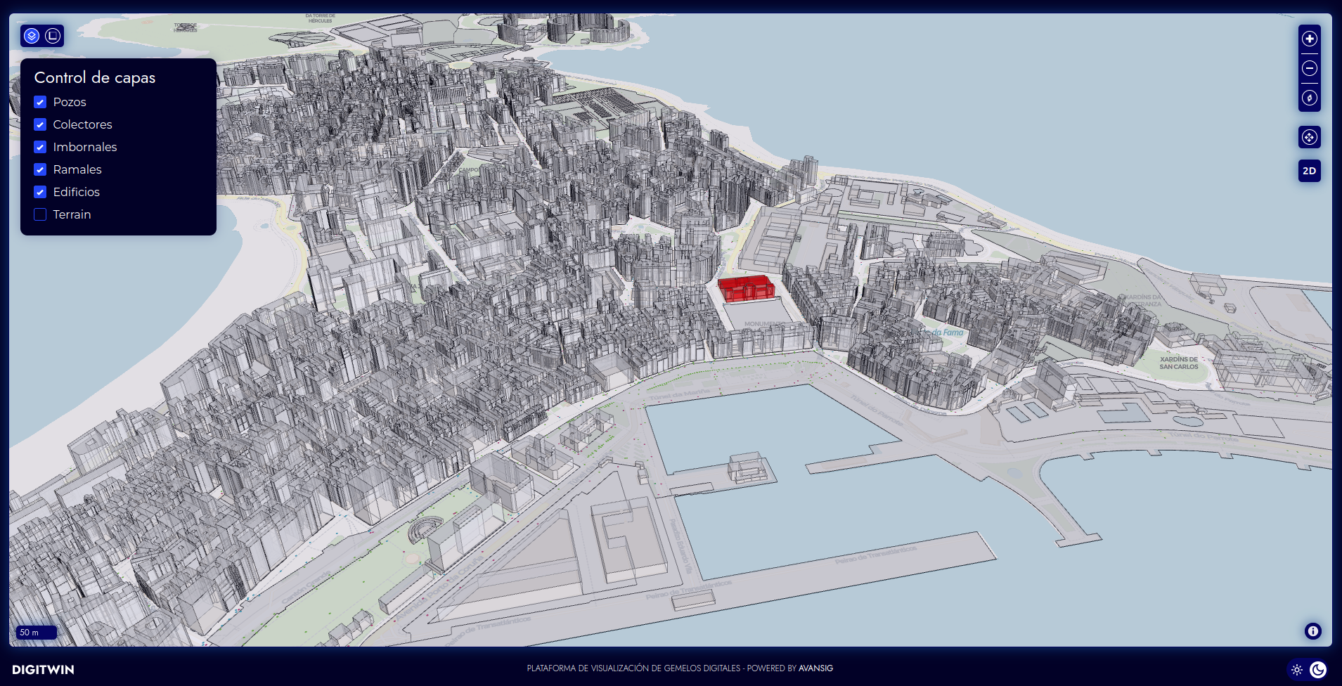
DIGITWIN
AVANSIG
Digital twin visualization platform combining 2D and 3D viewers. Base project for future developments requiring digital twins.
I participated in the development of DIGITWIN, a versatile digital twin visualization platform that integrates 2D (OpenLayers) and 3D (MapLibre GL) viewers in a unified interface. The system allows loading, visualizing and analyzing digital terrain models and 3D buildings, offering an immersive experience for urban infrastructure management. My contribution focused on implementing key viewer functionalities and integrating the different rendering engines, laying the groundwork for Avansig to tackle new digital twin projects with a proven architecture.
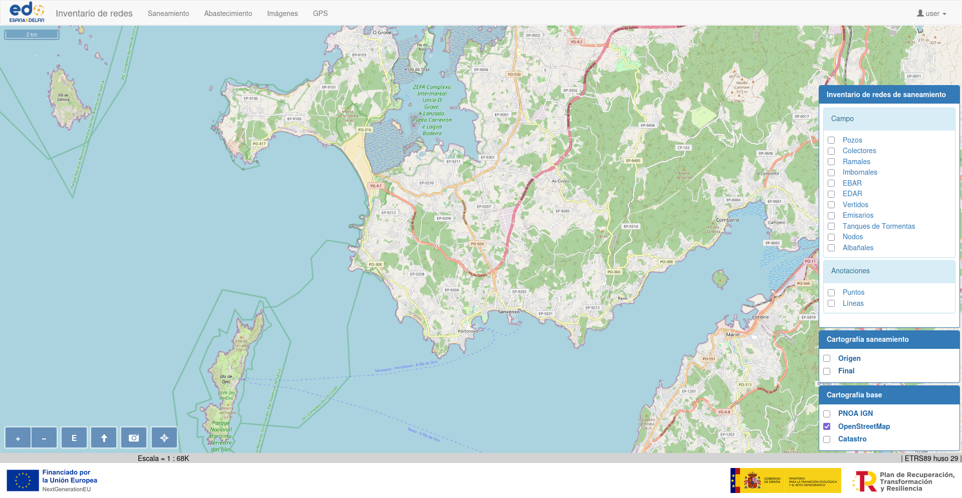
GIGA - Water Network Inventory
Espina y Delfín SL
Hydraulic infrastructure management and inventory system. Enables digitalization and editing of water supply and sanitation networks through an interactive, multi-device cartographic viewer.
As part of the development team, my work focused on creating and optimizing the platform's central cartographic viewer, designed for the integrated management of water and sanitation assets. I participated in implementing tools for digitalizing complex geometries (points, lines, and polygons) and developing the module for importing precise data captured via GPS stations. Cross-functionally, I collaborated on integrating advanced 3D viewers using technologies like MapLibre and OpenLayers, improving network visualization and user experience across web and mobile environments.
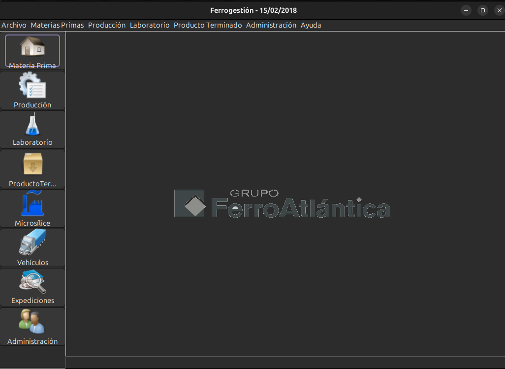
Ferrogestión
Ferroglobe (Ferroatlántica)
Integrated system for industrial production process management. Controls the full plant flow: from input logistics and manufacturing to shipping and reporting.
This industrial management software stands out for its extraordinary robustness, having operated uninterruptedly for over a decade in a high-demand environment. The system centralizes total factory traceability, including truck weighing and entry, manufacturing control, and finished product shipping. My intervention focused on updating the operational reporting module, working on a solid architecture based on Java 6. Collaborating on the maintenance of this system alongside the original project leads has been an engineering lesson in building enduring, reliable, and critical software for the industrial supply chain.
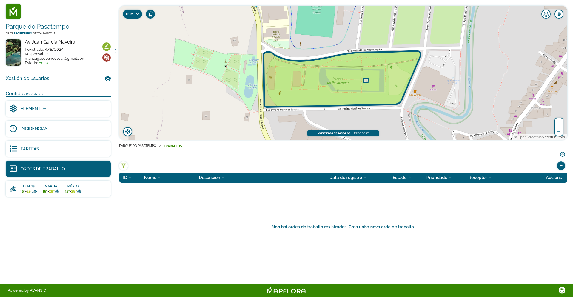
MapFlora
Avansig (R&D&I Product)
Digital ecosystem for intelligent green space and forest mass management. Uses digital twins and predictive algorithms to automate preventive maintenance and environmental conservation.
MapFlora represents the start of my journey at Avansig and is a project in which I continue to actively participate. As a core member of the development team, I was responsible for creating most of the interactive viewer, fully implementing the plot creation and editing tools. A key technical milestone was the direct integration with the Cadastre (Catastro), significantly facilitating the digitalization and management of green spaces for the end user. Additionally, I collaborated on R&D+i features such as plant growth simulation using predictive algorithms and meteorological data integration for customized care recommendations. The system supports sustainable forest management, positioning technology as an ally against climate change.
Personal projects of experimentation and technological innovation
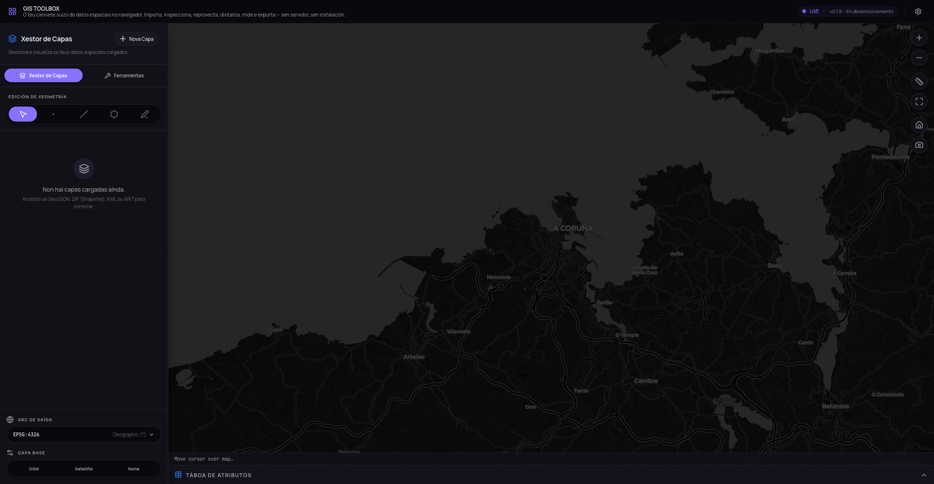
GIS Toolbox
GIS Toolbox — In-browser Geospatial Suite
Exploration, editing, and transformation of spatial data without server dependencies. A complete WebGIS toolbox.
GIS Toolbox is a browser-native spatial processing suite built on OpenLayers and Proj4js. It supports importing GeoJSON, Shapefiles (.zip), KML and WKT with drag & drop. Multi-layer management with custom colors and opacity, 13+ offline EPSG codes (plus live custom EPSG lookup), QGIS-style inline measurement tool, an attribute table with sorting and filtering, per-layer geometry statistics (area, length, bounding box), multi-format export (GeoJSON/KML/WKT), and a live coordinate bar. Zero server-side processing.
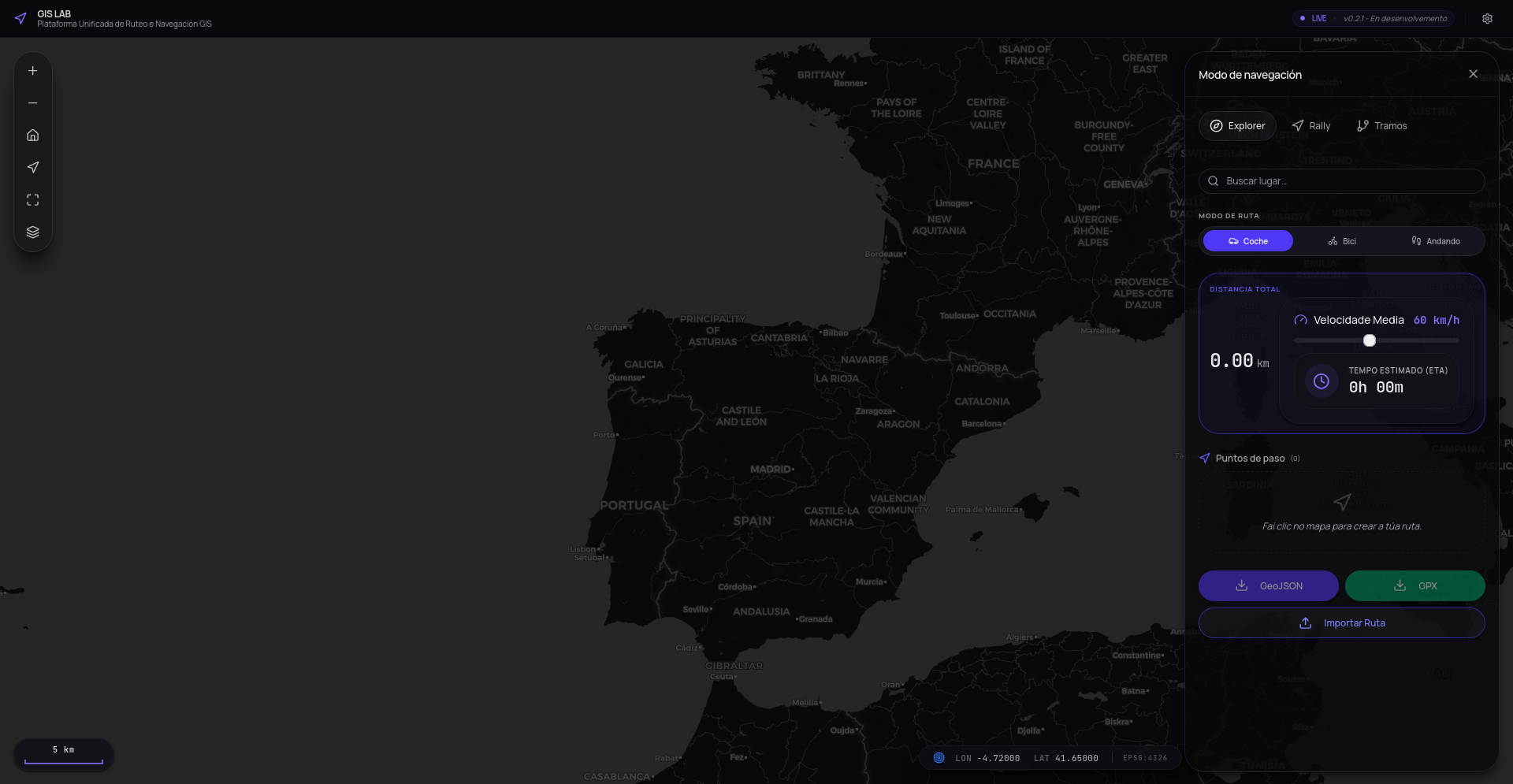
Rally Lab
Professional Rally Organizer
Specialized tool for rally organizers: draw SS stages, classify surfaces, manage CPs and TCs, and export in GPX/GeoJSON.
Rally Lab is the central platform for planning and organizing rally events. It integrates real-time routing with OSRM, surface classification (tarmac, fesh-fesh, stone), management of special markers (start, finish, CPs, TCs, danger zones) and areas (service park, parc fermé, spectators). Automatically generates roadbooks with elevation profiles and exports stages in GPX and GeoJSON. Designed Mobile-First for field use by organizers.
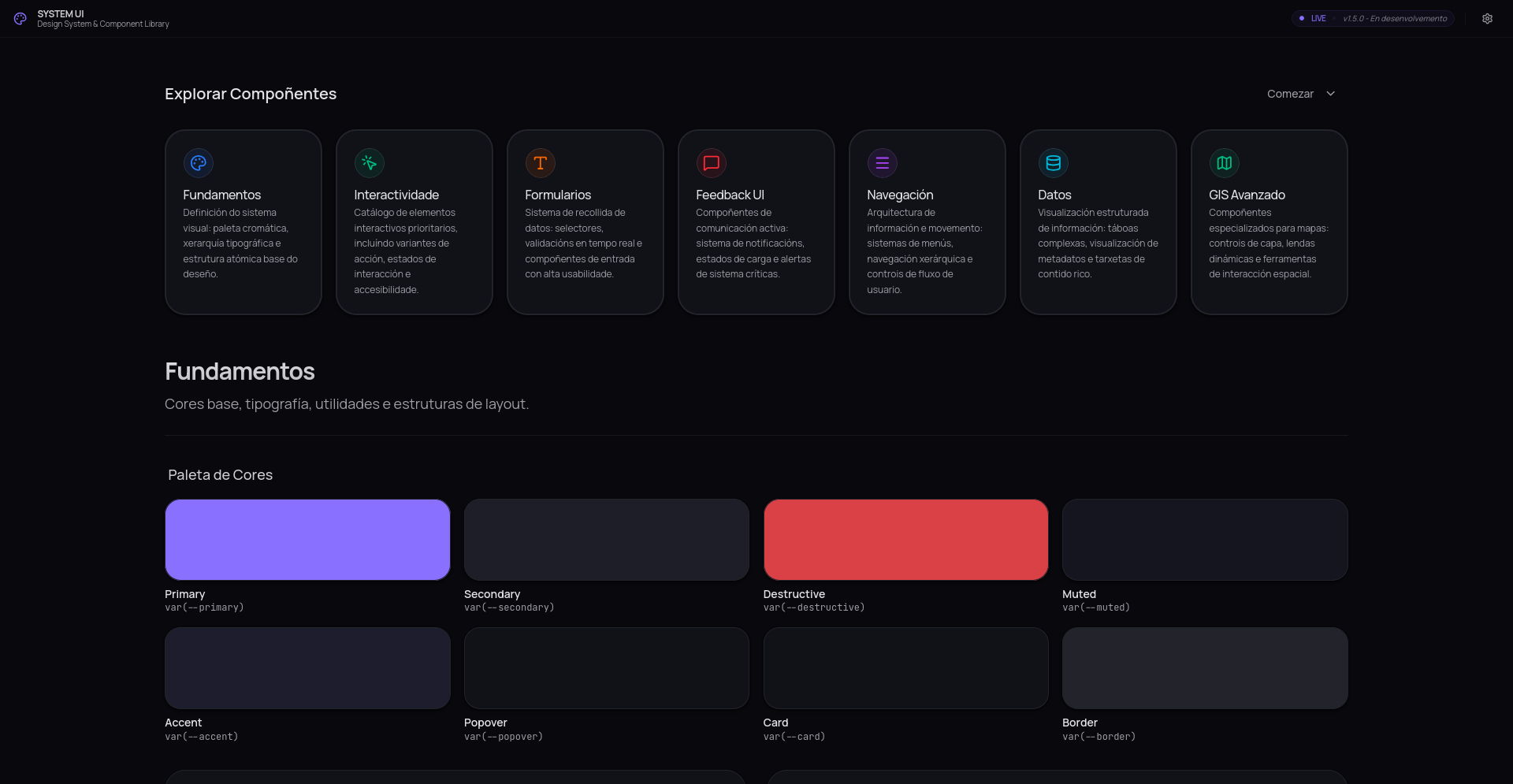
Design System
Interface Engineering (UI)
Strongly typed atomic component ecosystem. Implementation of Design Tokens for visual consistency, accessibility (a11y), and modular scalability based on Shadcn/UI.
Development of a modular UI architecture focused on Developer Experience (DX) and performance. Using React, TypeScript, and Tailwind CSS based on Shadcn/UI, I built a scalable design system that ensures compliance with accessibility standards (WCAG). This technical approach allows for the rapid deployment of complex corporate interfaces, ensuring optimal DOM rendering and an unshakeable visual identity across multiple applications.
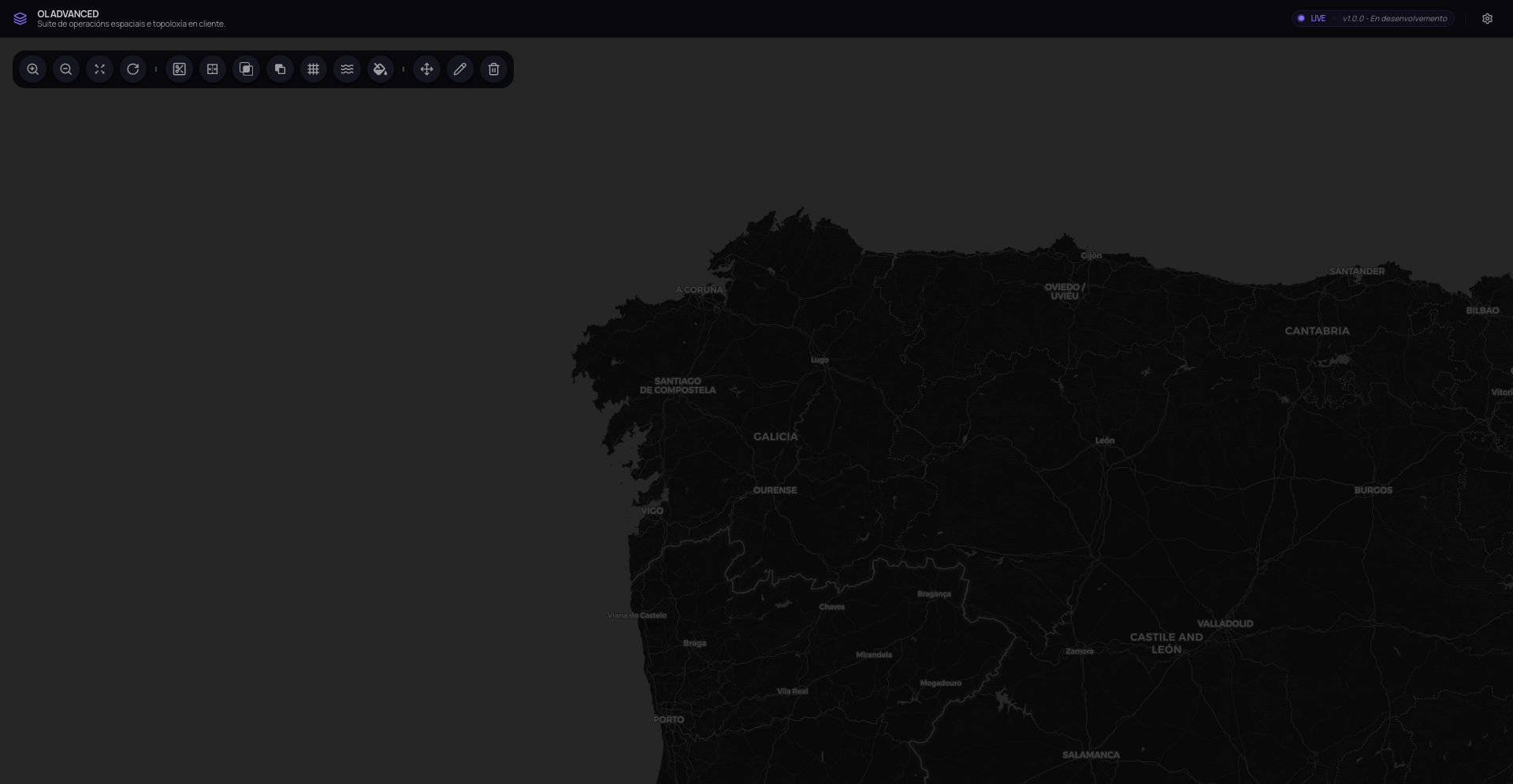
OL Advanced
GIS & WebGIS Architecture
High-performance vector rendering engine based on OpenLayers. Implements precise digitization algorithms, topology management, and advanced geospatial geometry manipulation.
This project originated from my Bachelor's Thesis (graded 9.5/10), which aimed to bridge the gap between web viewers and classic desktop GIS software (such as QGIS or ArcGIS). I designed and implemented a suite of advanced tools for vector manipulation directly in the browser, including polygon splitting and merging, as well as complex boolean operations (intersection, difference) using TypeScript and the JTS library. The result is a geospatial engine highly optimized for real-time topological analysis.
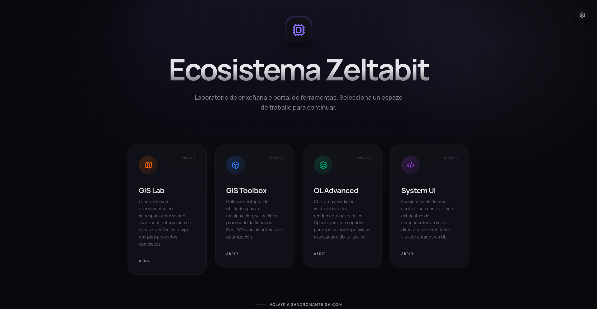
ZeltaBit
Zeltabit Ecosystem & Spatial Engineering
High-resolution platform that has evolved from hardware consulting into an ecosystem of advanced SaaS tools for spatial engineering.
Zeltabit represents my vision of end-to-end engineering. What began as a high-performance computing (HPC) hardware lab is now the command center for professional WebGIS suites. This evolution allows for bridging raw power with premium user interfaces, serving as the core for projects like Rally Lab and GIS Toolbox.
GitHub Profile
Research and Development
Central repository for continuous experimentation (R&D). Contains community contributions, proofs of concept with emerging technologies, and refactoring of legacy architectures.
Tell me what you need and I'll guide you to the right solution. No commitment.
I am a Computer Engineer graduated from Universidade da Coruña. My technical focus lies at the exact intersection of traditional Software Engineering and Spatial Data Science.
I don't just put points on a map; I build the entire infrastructure to manage, analyze, and visualize geographic data at an industrial scale. From developing spatial optimization algorithms (Dijkstra, Pareto) to robust backend architectures with Java Spring Boot and dynamic frontends with React. I am currently completing a Master's in GIS to stay at the forefront of geospatial technologies, always seeking the perfect balance between clean code, performance, and a seamless user experience.
Solid Architecture & Clean Code
I design and implement architectures based on SOLID principles and Clean Architecture. My priority is to create maintainable, testable, and highly scalable codebases for critical industrial environments, reducing technical debt from day zero.
GIS Engineering & Analysis
Expert in the corporate geospatial ecosystem. I build high-performance spatial data infrastructures (SDI), advanced web viewers with OpenLayers, and real-time interactive topological analysis engines.
Full-Stack Development
Comprehensive mastery of the software lifecycle. From orchestrating microservices with Spring Boot and PostGIS in the backend, to creating accessible, fluid, and modular interfaces using React and TypeScript.
Professional Path
Master in Geographic Information Technologies and Spatial Data Science
Universitat de Girona (UNIGIS)Advanced training in Spatial Data Science. Specialization in spatial analysis, predictive modeling, geospatial databases, and WebGIS application development.
The UNIGIS program at the Universitat de Girona is an international academic reference. Through this master's degree, I am deepening my knowledge in advanced spatial database design, remote sensing, predictive modeling, and the creation of spatial data infrastructures (SDI). This specialization allows me to tackle complex geographic problems and design WebGIS solutions that meet the highest standards of the geospatial industry.
Full-Stack & Geospatial Data Engineer
Avansig S.L.Technical leadership in the development of industrial Web GIS platforms and corporate data portals. Implementation of spatial optimization algorithms and scalable architectures with Spring Boot, React, and Docker.
Since joining Avansig, my work has focused on the intersection of software engineering and geospatial technologies. As a Full-Stack Engineer, I participate in the full lifecycle of high-demand corporate solutions, providing a technical vision that combines robust Java architectures with dynamic interfaces for spatial data visualization. My approach involves applying software engineering principles to complex geographic problems, ensuring that the developed tools are not only functionally accurate from a GIS perspective but also scalable, efficient, and aligned with industrial-grade quality standards.
Bachelor's Degree in Computer Engineering
Universidade da CoruñaMajor in Computing. Bachelor's Thesis (graded 9.5/10) focused on the development of advanced geometric editing algorithmic tools using JTS and OpenLayers.
During my Bachelor's degree, I acquired a rigorous scientific foundation by completing the intensive Computing specialization. My training focused on advanced algorithms, artificial intelligence, and the design of complex software architectures. This theoretical basis was essential for my Bachelor's Thesis (graded 9.5/10), where I applied topological concepts to develop geometric manipulation tools that served as the foundation for my subsequent GIS specialization.
Founder & Technical Advisor
ZeltaBitConsultancy specialized in High-Performance Computing (HPC). Comprehensive project management, assembly of servers and workstations for high-performance simulation.
As the founder of this consultancy, I took full technical responsibility for all projects. I specialized in the design, assembly, and maintenance of High-Performance Computing (HPC) hardware oriented towards 3D simulation and professional rendering. This entrepreneurial stage forged my troubleshooting skills and provided me with a comprehensive view of the physical infrastructures on which critical software systems operate.
Tech Stack
Backend & Core
Development of robust server architectures and scalable APIs.
Frontend & GIS
Creation of interactive user interfaces and mapping engines.
Data & DevOps
Spatial data modeling, automation, and continuous deployment.